Travesía Panamericana
Week 2
Travesía Panamericana
Week 2
|
|||||
|
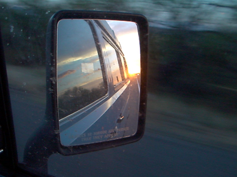
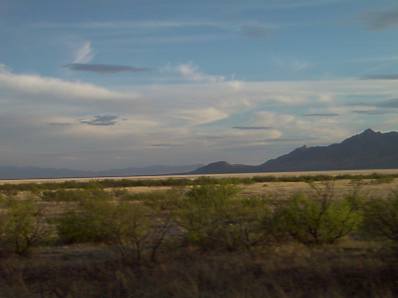
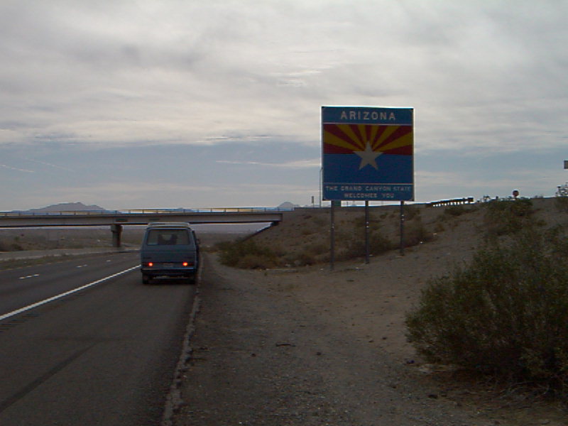
April 15, 2002 Rest Area close to the Arizona border (I-10) Odometer: 198,197 Written by: Cris Woke up early in a rest area close to Blythe, in the middle of a sandstorm. Chance slept outside of the car and was full of sand and with a sad looking face. We are very happy with Chances behavior so far, it must be so hard for him to be constantly on the move, and yet he has not complained once since we left. We headed east on I-10, and had breakfast in a much nicer rest area on the Arizona side (see photo). What a difference some (native) landscaping and cleanliness makes. They even had tidy gravel squares raked in artistic patterns under each parking space to catch any dripping oil We kept driving amongst huge trucks that kept passing us at great speeds, especially going uphill. At our average cruising speed (60-65 mph), we seem to be a big nuisance to all the trucks. This will surely change once we cross the border and people are not in such a rush and so concerned with efficiency and productivity. Right before reaching Tucson I saw a junkyard next to the freeway and got lucky; it had a late model Vanagon Westfalia with almost all of its parts in it, including the almost complete grey interior. Got the few parts I still needed and couldnt resist taking some more, such as the curtain set. I also took one of the table assemblies, but Barbara-in her infinite wisdom-made me return it before we hauled it all over Latin America. Under other circumstances I would no doubt have taken all of the interior, since it was such a rare find. We made it into Tucson exactly at 6:00 PM, just seconds after the local Camping World store had closed. After begging (we can be pretty good at it), they let us in and allowed us to return an expensive water filter that was not compatible with the Westfalia. Tired but happy with our success we kept driving on I-8 and other secondary highways until we reached the little town of Tombstone, around 10:00 PM. A local motel/RV park owner let us park our vehicle for free (we dont use any hookups), and a few minutes later we were sound asleepChance barked in a couple of instances during the night as he heard noises. This is something that he had never done and both of us were happy to see happening, since we will need more of a guard dog than he usually is from now on.
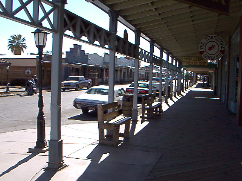
April 16, 2002 Tombstone, Arizona Odometer: 198,564 Written by: Barbara We woke up early as usual (5:30-6:00 AM), walked around town and learned
more about its history. Definitively a Far West motif. Old Saloons, museums about life in the far west, souvernir shops in
well-preserved buildings and a theatre-The Bird Cage- populated the main street. The theater was a popular entretainment,
prostitution and betting center in the 1880s. We left Tombstone in the afternoon and headed to nearby Bisbee, which was
a pleasant surprise. For a moment it really looked as an European village, tuck between the adjacent mountains and with a
very interesting architecture and narrow streets. We parked in a neraby lot and spent another quiet night.
April 17, 2002 Bisbee, Arizona Odometer: 198,606 Written by: both We walked Bisbees historic downtown distric very early in the morning, quite
different from the busy scene observed the prior night. Took a lot of photos of the citys historic buildings, and enjoyed
the urban density qualities that this town has to offer. On top of the latter, the place has a god share of bars, restaurants
and coffe shops. The locals also claim to have the best weather in the whole country, year round. If today had the average
Bisbee weather, we can atest that their claim is true! Another characteristic that we found in this city is that there is
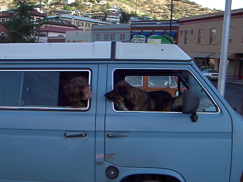
a great concentration of VWs from all vintages, something unseen in the rest of the state.
We took care of the last paperwork that needed to be done in the US, via
internet (Public Library, again), and US mail. We learned a bit about Bisbees history, a city that for many decades was dependant
on the operations of the Phelts Dodge Mining Co. After the downsizing of the mentioned company, the place received a hippie/artist
migration in the 70s, and was victim of a deep economic recession in the 80s (You could do a city census by throwing a nickel
down Main St, a local VW mechanic told us). The day went by really fast, we did some shopping in the last Safeway supermarket
that we will see in many, many months; bought Mexican insurance; filled up the tank with diesel and drove to the nearby town
of Naco, AZ with intentions of crossing into Naco, Sonora (Mexico). WE CROSSED OUR FIRST BORDER!!! The Naco border crossing is very easy given that both towns are tiny and
theres little traffic. Even so, the migratory paperwork lasted around forty-five minutes (despite the fact that we were the
only ones crossing the border at that moment). But the immigration bureaucracy should never be underestimated. We had tried
to anticipate any problem by diligently consulting two different guides about Mexico. We knew exactly what kind of documentation
we would need, photocopies of which documents, fees, etc. However, we were not ready to deal with a migrations officer who
was filling out forms and asking us questions while watching a soap opera in a small TV, and then, with another officer in
charge of processing the vehicle paperwork, who was also watching TV. Because of the contradictory and confusing information
of these two officers (or perhaps our own lack of understanding), we started bouncing from one office to the other for some
time. We were not in a big hurry, so we took it easy (however, in the back of our minds we were a bit worried because we wanted
to reach Nuevo Casas Grandes before it was dark).
We took route 2 and for three hours and a half we went through a spectacular
desert landscape: dry plains alternating with rolling mountains, and the road surrounded by cacti, blooming ocatillos and
other plants of the desert. The colours varied between pink, ocre, orange, light green, and white, in contrast with the blue
skyall colored by the orange-pink light of the sunset. In some ares there was creek that watered with green the surrounding
areas, where the vegetation was lusher and with more intense colors. It was very pleasant to drive through this area, although
we were surprised by how militarized it was and with the level of surveillanceprobably because how close we were to the U.S.
border. In different portions of the route we had to stop at various control ckeckpoints: customs, judicial police (who were
exhaustively checking a few vehicles), sanitary control, and cattle control (these two operated by military men with guns,
instead of civilians).
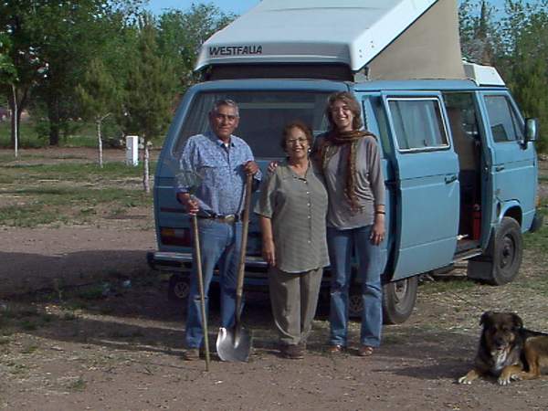
Finally, we arrived at Nuevo Casas Grandes and we stopped at the RV Park
Los Metates, where the owners, Don Tito and Doña Mara (see photo), made us a very good deal. Los Metates was a very pleasant
place, partly farm with chickens and rabbits, partly handicraft shop, partly beauty salon, partly car wash, and partly RV
Parkall run by different members of the family (the ones we met were extremely friendly, resourceful, and with much ingenuity).
We were very happy at Los Metates, so our first night in Mexico was a good experience.
April 18, 2002 Nuevos Casas Grandes, Chihuahua. Mexico. Odometer: 198,796 Written by: Barbara We woke up early in Los Metates, had breakfast, and spent some time doing
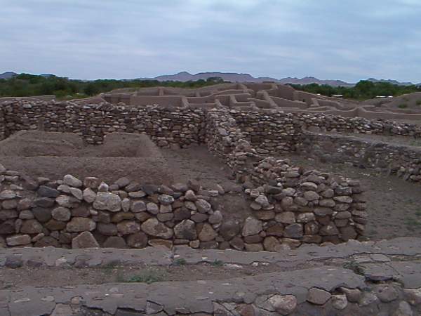
little projects. Around 11am, we left toward the ruins of Paquime, located in the area surrounding Casas Grandes (the older
village). The ruins are made of adobe and give you an idea of the civilization that lived in the area from 900 to 1300 AD.
It was interesting to find out about the links between the Paquime culture and other pre-hispanic cultures that lived in Arizona,
Colorado, and New Mexico during the same period. Next to the ruins there is a first class museum, with architectural spaces
that play with the light, angles, contours, textures, and exhibits in a creative way. In the museum we saw many pottery works
with exquisite designs representing human figures, rituals, animals, and geometric designs.After doing some grocery shopping
(tasty cheese!) and a bit of internet in a local café with a very slow connection, we slept at Los Metates for the second
time. Staying at Los Metates gave us the opportunity to learn a bit more about different features of the area. For example,
Don Tito explained to us how a system of irrigation through acueducts allows different land holdings to be watered at differet
turns. We were at Los Metates during the time the water came to the part of town where los Metates was located, so we saw
how it works. Don Tito also showed me the rabbits and chickens he is raising, and told us the history of the different aspects
of his business. I was impressed by the hard work and ingenuity of this family.
April 19, 2002 Nuevo Casas Grandes, Chihuahua. Mexico Odometer: 198,825 Written by: Cris After buying some more wonderful cheese in a local queseria, we headed south
towards Creel, up in the Sierra Madres Copper Canyon, epicenter of the Tarahumara land. I had visited the canyon by train
from Los Mochis in the past, but was anxious to get to know the area a bit better this time. The road kept climbing in elevation,
and the temperature was quite pleasant. As a matter of fact, we had not encountered extreme or uncomfortable temperatures
yet. Another thing that we hadnt encounter up to that point were toll roads, a pretty common and expensive Mexican feature.
The landscape kept changing as we went up, we saw Ocatillos, cacti, and other desert plants, which turned into pine forests
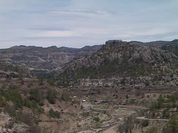
later on. The GPS showed over 8,000 feet above sea level in some instances. We made it into Creel around 6:00 PM, and kept
driving a few miles to Arareko lake (see photo), which is managed by the Tarahumaras and has a camping area. Other than a
few locals fishing, no one else was there. We chose a spot with lake view among the pine trees and went to sleep after a homemade
dinner in our little stove.
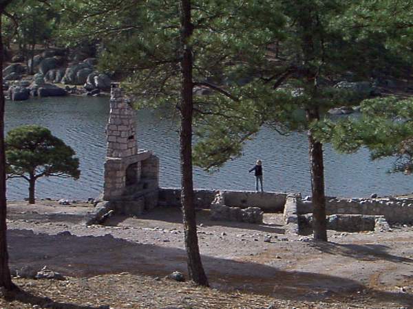
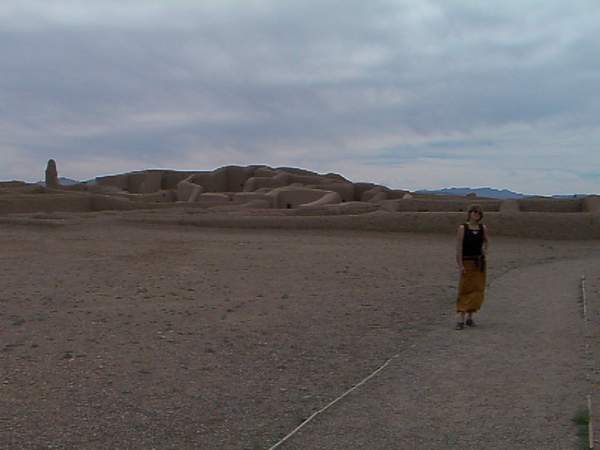
April 20, 2002 Lago Arareko, Sierra Tarahumara, Mexico Odometer: 199,100 Written by Barbara Lago Arareko's morning solitude was only interrupted by a few singing birds.
After breakfast, we went to the lake and walked on the stone ruins of what must have been a big building with a huge fire
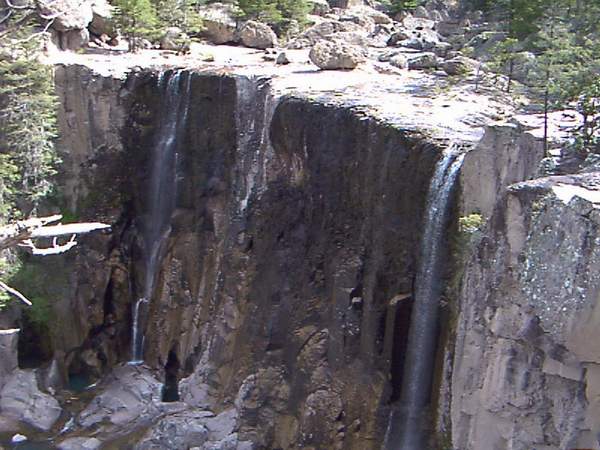
place (see photo). We never found out when it was built or who made it. We left the lake area and headed to the Cuazarare
waterfall (see photo). In the trailhead to the waterfall and throughout the trail, we saw a few Tarahumara people (all very
reserved), including women dressed in traditional colorful clothing (such as skirts and shalls made of red, green, orange
and other bright colors). Some of these women were selling handicrafts, especially woven items with various colors and intricate
designs. The waterfall is about 30 meters high and quite beautiful, even though there was not too much water during this part
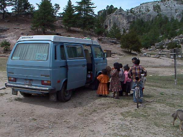
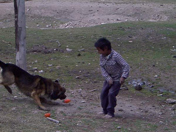
of the year. When we came back, a bunch of Tarahumara kids approached us. We were not sure what was going on because they
were speaking their indigenous language. Then it became apparent that they were intrigued by our dog Chance, and wanted to
pet him. In a minute they were all playing, running around, throwing sticks and balls to Chance, who was jumping and running
in a frenzy. We were all laughing really hard, and it felt very good. Afterwards we drove through the Copper Canyon, which
is composed by 20 different canyons, and that according to the Lonely Planet guide, are together larger than Arizonas Grand
Canyon. We drove slowly because the road was steep and winding.
April 21, 2002 Hidalgo del Parral, Durango, Mexico Odometer: 199, 328 Written by: Barbara We left Parral heading to the city of Durango. We crossed a very dry and
hot desert, sprinkled by a few villages here and there. It was the first time in the trip that we experienced real heat (even
though it will probably get hotter and hotter in the summer). Still, we were happy for having chosen this road (route 45),
which was in very good condition and with little traffic. Based on our experience so far, we would recommend to take these
kinds of roads instead of the four-lane toll roads, that might be faster, but expensive and probably not as beautiful (we
are not talking about taking the roads alternative to the toll roads, but a different route altogether, where there are no
toll roads). In the late afternoon, we arrived in Durango, another lively city, with many people hanging out in the main plaza.
We stayed in a hotel/RV park with a nice grassy area, getting a good deal: we slept in the Westfalia, but had access to the
shower and bathroom of one nice room. Our next stop is the silver town of Zacatecas.
|
||||||||||||||||||||||||||||
|
|
||||||||||||||||||||||||||||